Loch Luna: a kayakers’ guide
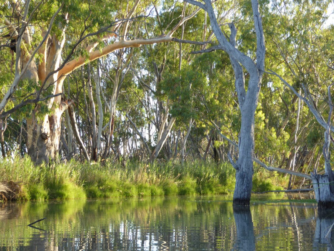
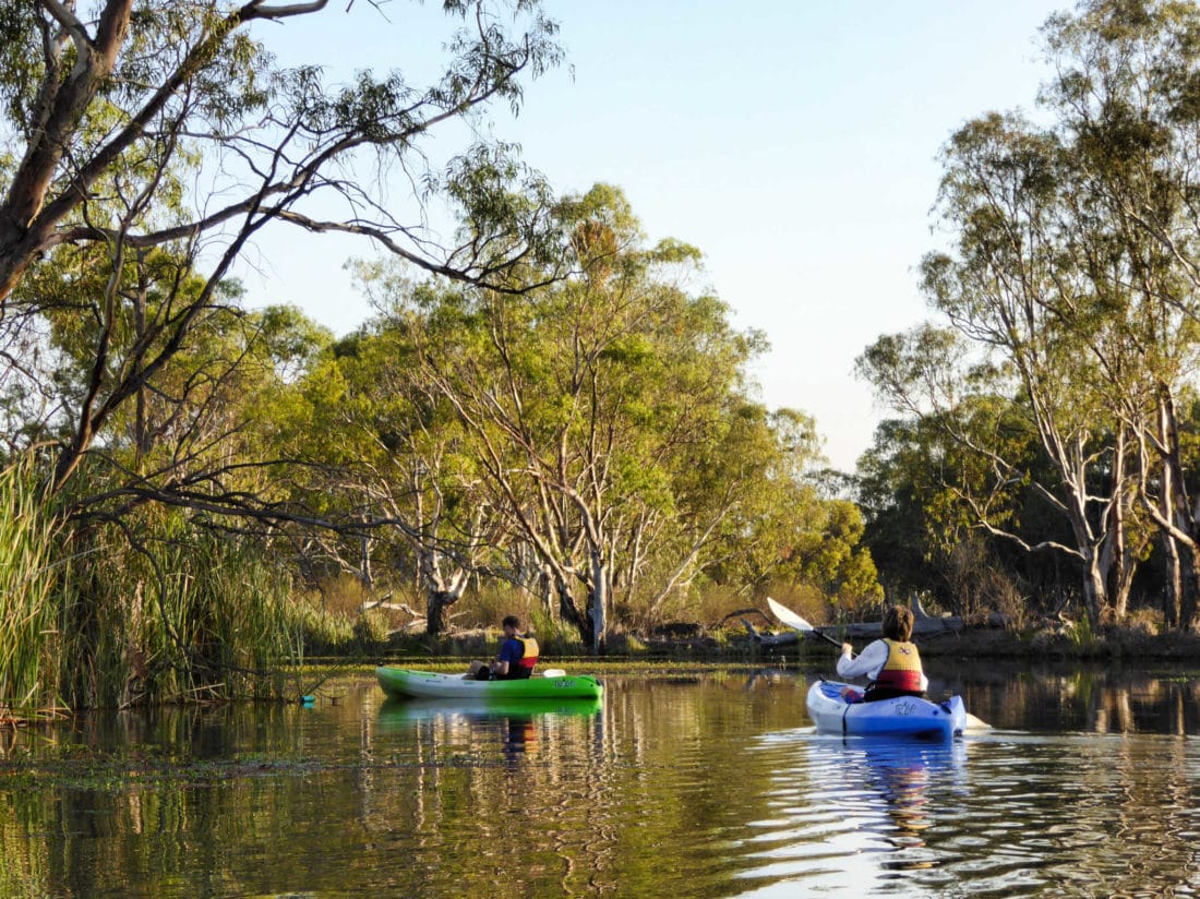
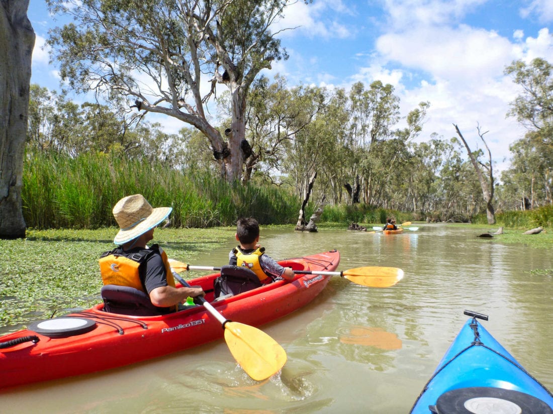
One of South Australia’s iconic paddling locations, Loch Luna Reserve includes Chambers Creek, Nockburra Creek and the 2 lakes of Loch Luna. It offers sheltered, slow-flowing flatwaters, in an especially scenic and interesting location for family-friendly kayaking fun. It is beautiful, and rich in birdlife, with the novelty of a maze of winding, narrow creeks, making for fun explorations.
Where is Loch Luna?
Loch Luna lays on the floodplain north of the Murray River, between Cobdogla and Lock 3, close to Kingston-on-Murray. It is the wonderful wetlands visible from the causeway leading to the Kingston bridge – on the Sturt Highway.
It is
- 220km 2 hrs 20 mins from Adelaide
- 40km, 25 minutes from Waikerie
- 24km, 20 minutes from Berri
- 40km, 28 minutes from Renmark
- 11km, 11 minutes from Barmera
What will we see?
- Low banks, mostly lined with reeds (a nice contrast to the grey clay banks seen frequently on the river.)
- Narrow winding creeks and open lakes
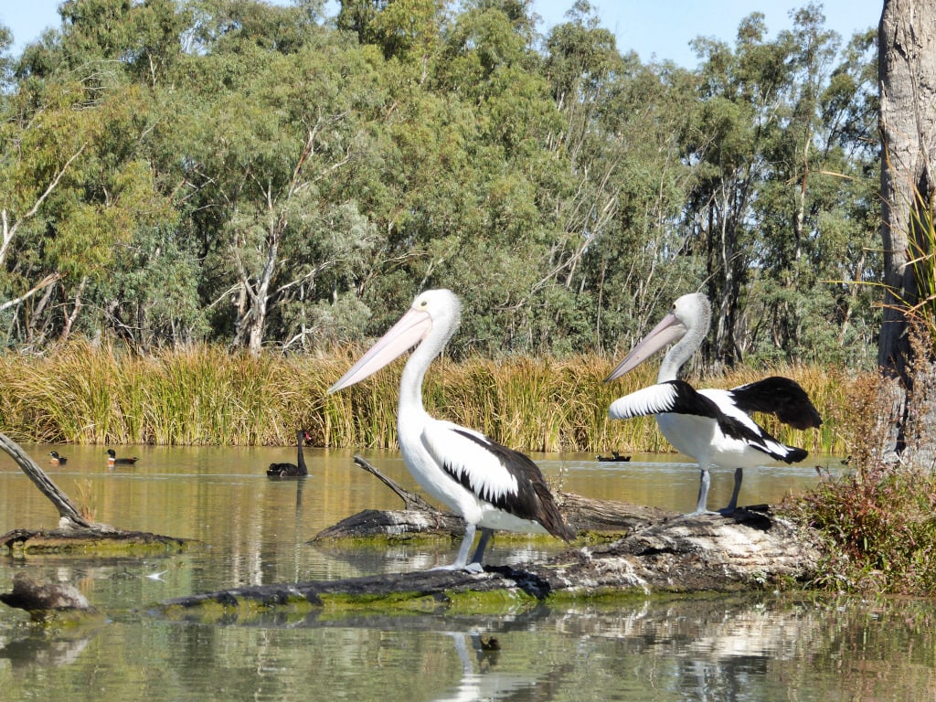
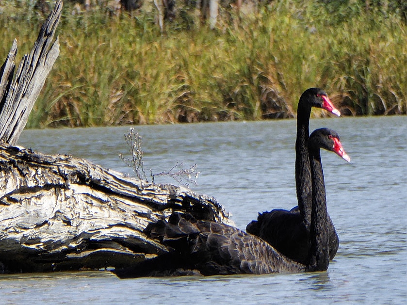
- Black swans, pelicans, whistling kite, darters, reed warblers and even regent parrots if you’re lucky
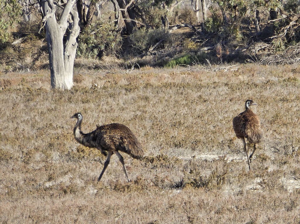
- Rakali, kangaroos, rainbow bee-eaters in season
- Canoe trees: the scars left on trees from the cutting of the bark to make canoes, many, many years ago.
- Navigation markers, trail markers
- Water Primrose, with its yellow flowers, floating on the water are an attractive addition.
- Azolla – a native floating fern, varying from rich red-brown, to bright green (sometimes ingloriously referred to as “duckweed”)
What is it like?
The creeks are narrow and shallow– quite accessible by kayak, (but not by speed boat, which is one of the blessings of this place, for kayakers)
Being just upstream of Lock 3 means the water level and flows are quite constant and predictable. Occasional weir pool manipulation of Lock 3 may see the level rise by around 20cm – Current information on flows is available here.
There are many towering dead gum trees – killed by the artificially raised water level caused by the building of nearby Lock 3 in 1925 – these make a great contrast with the lush green of the reeds and wonderful silhouettes at sunrise and sunset. Their hollows are the homes to birds and their forks hold Whistling kite nests: a conspicuous, large, high nest in Chambers Creek, north west of the “official canoe launch” is a useful navigation point.
maps
We have laminated maps available to purchase as a download, or a hard copy. If you hire your kayaks from us, these maps are automatically supplied along with pfds, paddles etc. Avenza linked trail information is available on the Paddling Trails SA app
round trip or one way?
Loch Luna is good for having a base camp that you can return to at night, and can give several days of leisurely kayaking, without having to backtrack many of the same bits of creek, due to its maze-like nature. If you wish to do a one-way trip, we can assist with relocating you and our (or your) kayaks back to your car.
where can i paddle?
Nockburra Creek is most sheltered and fun to explore around all of the twists and turns. Most maps will let you down in this area, not showing that some of the creeks are blocked by reeds – discovering the blockages by trial and error can add an extra 2km to your trip. We have produced our own accurate maps which are available by mail-out or download.
The lakes are inhabited by large flocks of cormorants, black swans and pelicans. They are best avoided on really windy days.
Thurk Island is in the River directly opposite the entrance to Nockburra Creek. (Hawker Creek on Google Maps) The island is full of interesting inlets and is a haven for birdlife.
Chamber’s Creek joins Lake Bonney to the Murray River. The Chambers Creek Canoe Trail starts at the official canoe launch and heads east. This picturesque trail includes the colourful sandstone cliffs of Sugarloaf Hill but can be navigationally confusing.
where to camp
Camping is at designated campsites which are bookable online with National Parks. The sites are reasonably sized with shade, but have no power, toilets or other facilities. They are suitable for tents, caravans and camper trailers. They all have water frontage, though in some sites that frontage is heavily reeded.
Campfires are allowed but seasonal fire restrictions apply – Note that firewood is not to be collected from inside the park.
The following summary divides the camping areas into 3 areas, divided according to access:
Loch Luna Campsites 1-11 on the north side of Chambers Creek/Nockburra Creek. The access point is 6km from the highway, off of the Barmera‐Morgan Road, near Nappers Bridge.
Kaiser Strip campsites 11(closed) 12, 13 & 14 are north of the highway, and just south of Nockburra Creek. Access is from up on the Kingston Bridge causeway, by turning north off of the highway 300m east of the river. Then, turn right onto the old bitumen road, and immediately turn left and head out across the floodplain.
Kaiser Strip campsites 1-10. WE DON’T RECOMMEND BOOKING HERE FOR KAYAKING IN THE LOCH LUNA CREEKS as they require several kilometres of paddling along the river and under the bridge to get access into the interesting paddling. These sites have constant exposure to traffic noise from the elevated causeway. They do however have access to toilets, and dogs on leads are permitted.
where to access the water if you aren't camping
The official “Canoe Launch” is now a floating launch with handles and rollers. It allows water access without needing to enter a campsite which might be booked already by someone else. It has space to leave cars parked. To find it - copy and paste these coordinates into maps.google.com -34.22357334268655, 140.37689654032607
(Post flood note 8.4.23 - access to the canoe launch is only via Shueard Rd, Cobdogla at the moment - in case I forget to update this note - it would be worth checking in May whether the access via the causeway is reopened.)
Alternative non-camping access is via the Sturt Highway, 3.2km east of the river crossing at the bridge, turn north onto Rogers Road follow it to its most north westerly point, before it turns east – there are no campsites here – but it is possible to launch here with care. To find it - copy and paste these coordinates into maps.google.com -34.22511130127084, 140.39530704980845
When to visit
Loch Luna is usually open all year, but after rain the grey clay tracks become inaccessible.
It would be wise to reconsider your visit on days rated as “catastrophic fire risk”
Is there anything I need to be careful of?
Rain fall and grey clay tracks are not a good mix, so when driving, take care
a) not to slip and
b) not to wreck the track for later use. Please keep to the tracks.
Some kayak trail maps are out of date, showing trails through areas that are blocked by reeds – following them may result in you having to do an unexpected extra hour of paddling – not a good idea when sunset is approaching.
·Waterfowl hunting is permitted in the reserves on declared open days. We recommend staying away on those day.
Fresh fruit and veg cannot be brought into the Riverland without an itemized South Australian supermarket receipt. Please abide by this to protect our horticulture industry from the devastation that fruit fly would cause.
Things to do near Loch Luna
Visit Berri for Berri Caravan Park’s awesome putt-putt golf course, drop in to Hook Line and Sinker for any extra camping needs, or a road-side fruit stall for a sample of fresh, ripe Riverland fruit.
Visit Barmera for a taste of local produce at Flavours of the Riverland, the Barmera Bakery or the Lakes Cafe, take a walk along the foreshore at Lake Bonney or try your hand at zorbing at the Bluebird Café.
where to stay near loch luna
If you'd like to hire kayaks to explore Loch Luna, or purchase a Loch Luna Kayak Trail map, please get in touch.